Geonotes is a tool that allows System users to efficiently share location-based and descriptive information between field and office users, as well as with the System Administrator.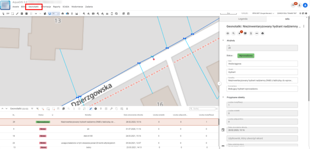
Use case:
- During a field visit, a hydrant was observed that is not present on the map.
- From the Mobile Application, we add a new Geonote by placing a point on the map to mark the hydrant’s location, and we fill in the descriptive attributes, for example, noting that it is aboveground, DN80, and properly marked with a plate.
- Finally, we add a photo of the hydrant as an attachment and save the changes.
- Next, the System user responsible for network updates, upon receiving information from the field worker, adds a new object in the Hydrants layer based on the Geonote information and changes its status from „new” to “entered.”