

 0
0 0
0 0
0 15 January 2026
Usemaps – a platform for collaboration on maps – is a tool that allows you to organise the flow of spatial information in your company. It makes it easy to ensure that everyone has access to the data they need, in a way that is convenient for them.
In addition, Usemaps has tools that enable relatively complex operations, which previously required specialist knowledge, to be performed more efficiently.
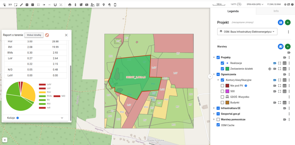
The film shows the process of searching for and analysing potential land for renewable energy investments. Of course, for the purposes of the film, the process is simplified.
What can we see in the film?
Usemaps user was tasked with finding a plot of land between 10 and 100 hectares north of Wągrowiec.
- Thanks to the Investment Area Search Engine, he found plots of land of the right size that are not located in protected areas and do not belong to the National Agricultural Support Centre or the Military Property Agency.
- It then automatically vectorized the land class data and calculated the plot coverage of each class
- Next, he calculated the parcel’s actual buildable area (taking into account the subtraction of forested areas and buffers around buildings) using the Usable Area tool.
- Next, he calculated the distance to the nearest substation (GPZ), using the Automatic Attribute Filling tool.
All this in just a few minutes, in your browser. I encourage you to take a look.
If you have any questions, feel free to contact me.