
 0
0 0
0 0
0 1 July 2026
Use Case – Land Bank Management
How the Katowice Special Economic Zone Manages Its Land Bank.
Investment sites
0
ha
Subzones
0
Unified database
0
Challenge
The Katowice Special Economic Zone manages investment sites across multiple locations throughout Poland. Each site has its own characteristics, including size, ownership, utilities, transport accessibility and market surroundings. Information about these investment sites was maintained separately by different people and stored in different locations. When an investor requested information about a specific site, gathering complete and up-to-date data took time, and there was always a risk that someone was working with outdated information.
There was another equally important challenge. KSSE does not simply offer square metres of land – it offers context. Investors need more than just the location of a site. They also need information about workforce availability, regional unemployment levels, transport infrastructure and the surrounding business environment.
Although this information was collected and regularly updated, there was no effective way to present it to investors in a clear, map-based format.
There was another equally important challenge. KSSE does not simply offer square metres of land – it offers context. Investors need more than just the location of a site. They also need information about workforce availability, regional unemployment levels, transport infrastructure and the surrounding business environment.
Although this information was collected and regularly updated, there was no effective way to present it to investors in a clear, map-based format.
Solution
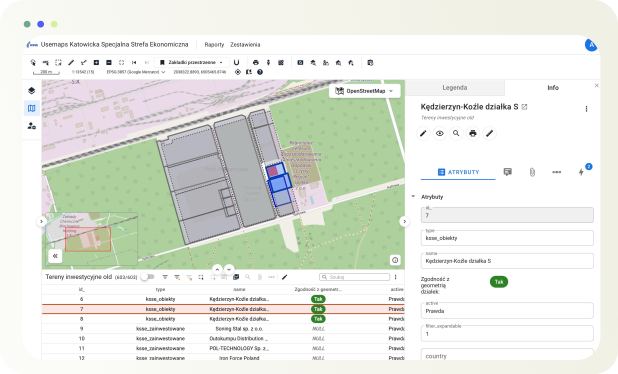
KSSE implemented Usemaps as a central platform for managing its land bank. Each investment site is represented as an object on the map, with a complete set of attributes, including size, status, ownership, utilities, photos and related documents. Every employee, regardless of their location, has access to the same up-to-date database through a web browser. Any changes made by one user are immediately available to everyone else.
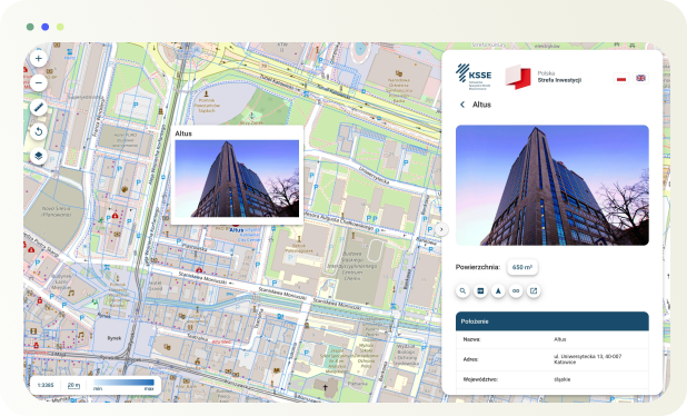
Alongside the internal working database, KSSE created a public investment map – a separate view based on the same data, but designed specifically for investors. It presents available investment sites together with their key parameters, enriched with contextual information such as regional unemployment levels, workforce availability and transport infrastructure. As a result, investors can see not only what is available, but also why it is worth investing there.
Alongside the internal working database, KSSE created a public investment map – a separate view based on the same data, but designed specifically for investors. It presents available investment sites together with their key parameters, enriched with contextual information such as regional unemployment levels, workforce availability and transport infrastructure. As a result, investors can see not only what is available, but also why it is worth investing there.
Results
The KSSE team now works with a single, unified database. There is no duplication of information, no uncertainty about which version is up to date, and no need to exchange files by email between different locations.
The investment offer is always up to date and publicly available in a format that builds trust among both domestic and international investors. Market context – including workforce data, the business environment and transport infrastructure – becomes an integral part of the investment offer, rather than a separate document attached to an email.
The investment offer is always up to date and publicly available in a format that builds trust among both domestic and international investors. Market context – including workforce data, the business environment and transport infrastructure – becomes an integral part of the investment offer, rather than a separate document attached to an email.
