

 0
0 0
0 0
0 16 February 2026
The Łódź Special Economic Zone manages several thousand hectares of investment land across multiple voivodeships. This includes hundreds of cadastral plots, thousands of documents, and tasks related to acquiring and servicing investors.
Before we started working together, this data was fragmented, and managing it was very time-consuming.
Main challenges:
- The list of plots covered by the zone was stored in a spreadsheet.
- Documents (contracts, correspondence, offers, investor templates) were stored in folders on a shared drive.
- Time-consuming and inefficient searching for sites that met the specified criteria
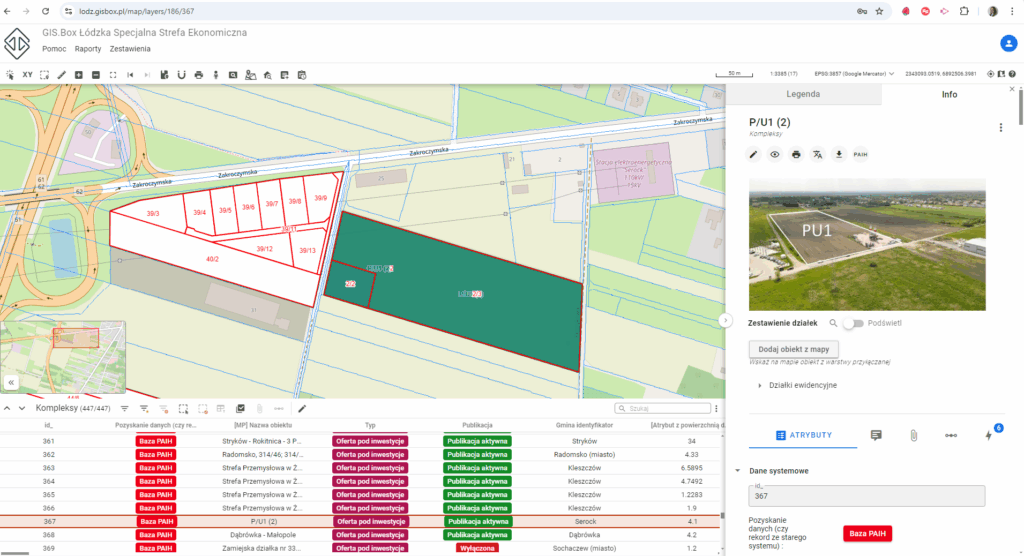
The client’s key expectations were:
- Quick identification of sites meeting specific criteria (e.g., area ~20 ha, flat terrain, gas connection, adequate electrical capacity, water supply, and ownership structure allowing for fast acquisition)
- Keeping the database up to date (things are constantly changing!)
- Fast, easy, and efficient analysis of sites proposed for inclusion in the zone.
- Ability to offer selected sites to potential investors.
The Łódź Special Economic Zone uses Usemaps Property in its daily operations.
The implemented solution enables:
- Real-time integration of the spreadsheet list of sites with map data.
- Using Usemaps Geoportal to create a publicly accessible map for all interested parties.
- Real-time generation of all informational materials based on always up-to-date data.
Key benefits of the implementation?
- Elimination of the risk of providing outdated data to potential investors – templates are always generated using up-to-date information.
- Finding a site that meets the investor’s criteria now takes minutes instead of hours.
Usemaps has become the “single source of truth” that all Zone employees use to access the most up-to-date information.