#30DayMapChallenge. Day 10. Focus on the atmosphere. Map weather, wind patterns, air traffic, pollution, or airborne transmission (e.g., pollen, sound).
Is it possible to make a map of something invisible to the naked eye? Yes… There are wind maps, some even animated.
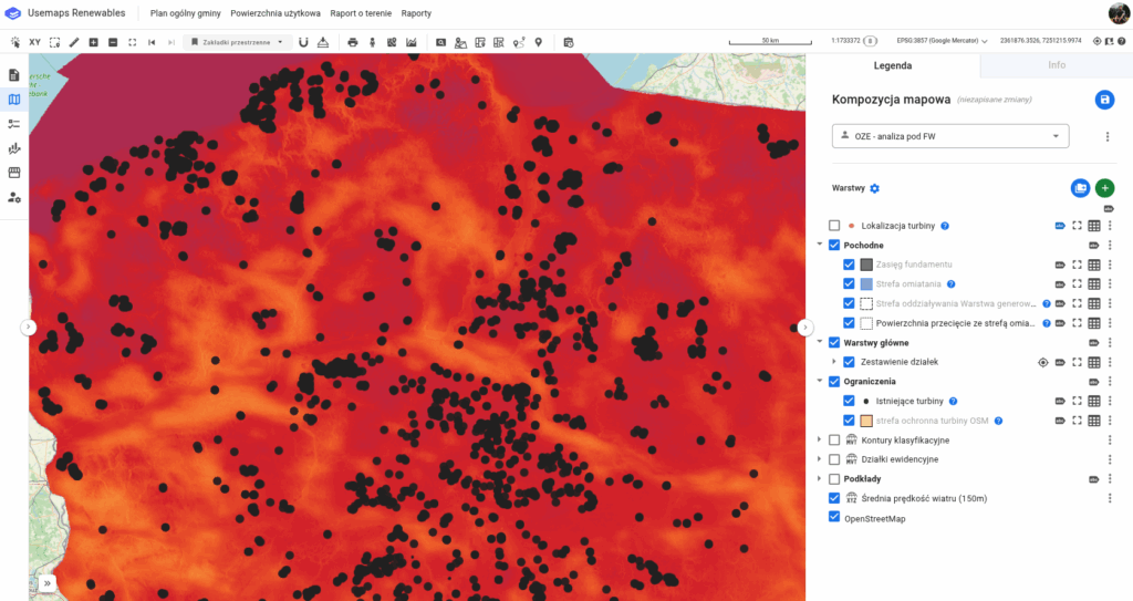
I recommend the Global Wind Atlas, a portal where you can view wind maps for the entire world. Averaged, at different heights – pure wonders.
The coolest part is that these maps can be downloaded and used, for example, to plan wind turbine locations.
On the map below, existing turbines in Poland (data from OpenStreetMap) are marked with black dots against the background of the average wind speed at 150m height.