The dynamic expansion of grocery store chains requires an efficient process for evaluating new locations. In many organizations, the analysis of potential sites is handled by several people, often working with different desktop tools. The result is repeated assessments of the same areas, a lack of up-to-date information on status, and hundreds of emails exchanged between the expansion team and management.
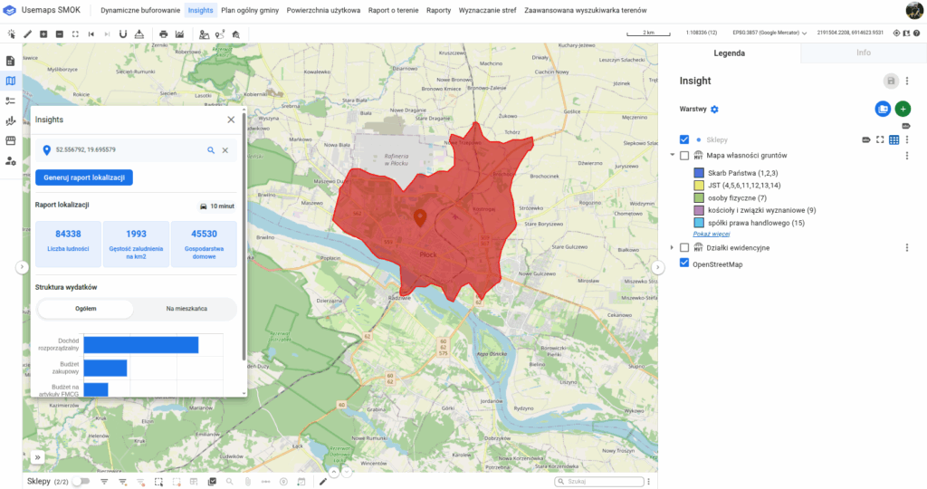
For years, expansion teams have been using GIS systems to analyze the potential of new locations. They utilize data on:
- the demographic structure and wealth of the residents of a given area,
- competition — number of stores, parking area, estimated number of customers,
- financial results of stores in similar locations, which allows forecasting revenue and profitability.
This process, although valuable, often ends up as a report passed along within the organization—without further automation or workflow control.
A part of this analysis is shown in a video on our YouTube channel
This is a fairly traditional approach, mostly carried out by a few people within the organization. They usually work on desktop software. The result of their work is reports, which constitute one of the data sets necessary for management to make decisions.
One of Usemaps’ clients, developing a nationwide network of grocery stores, decided to integrate the entire expansion process into a single GIS environment – from the moment a location is submitted to the monitoring of the store’s construction.
Thanks to Usemaps Retail, it was possible to:
- eliminate communication chaos – instead of emails and Excel sheets, all data, statuses, and comments are stored in a single system,
- avoid duplicating work – field employees have access to historical locations, so they don’t reanalyze the same sites,
- automate location assessment – once a new point is added, the system automatically performs a preliminary analysis and assigns tasks to the appropriate team members,
- streamline access management – the system is installed in the client’s infrastructure and integrated with the internal user authorization system.
- The expansion department manages the system and has full access rights,
- Field employees edit data only within their own regions,
- Management has access to current statuses and reports.
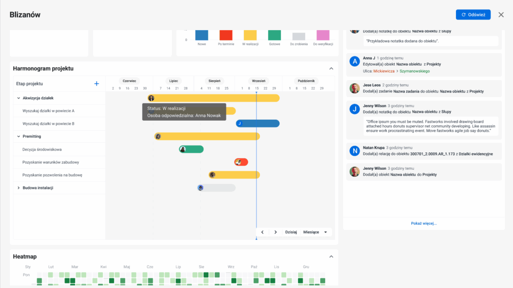
The entire decision-making process – from the idea of a new location to the start of construction – takes place without sending a single email.
At weekly meetings, management uses project dashboards that display work progress, investment statuses, and completion timelines.